Real Estate Fly Through
Super fun fly through for a real estate property video in Hana Maui. It took a few tries but we got a good shot and I got to play some …
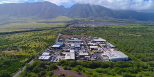
Professional Aerial Imagery
Videos for showing the beauty of a property for real estate sales purposes
Super fun fly through for a real estate property video in Hana Maui. It took a few tries but we got a good shot and I got to play some …
This 47 acre property presented a significant challenge in that it was located half in and half out of an FAA Authorization Zone. In order to photograph and survey the …
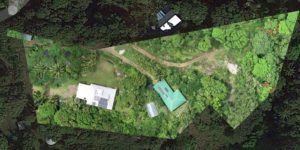
We are now able to import government derived Property Boundary Maps directly into the drone software to create a survey parcel map with boundary lines GIS accurate within inches. Great …

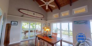
Real Estate videos can really show off the features of a property and give the agent an important tool in reaching that target market
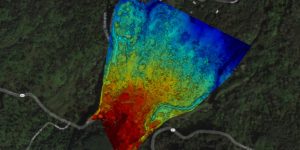
Drone surveying is a powerful tool for assessing undeveloped land, determining topography, examining plant health, and planning development.
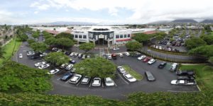
Cheaper than helicopter based aerial photography, drone based surveying can give you that bird’s eye view for a fraction of the cost. Commercial or residential lots, build progress, resource management …