Drone-based property scans and stitch photo surveys (often called Photogrammetry) have changed the way real estate, construction, and insurance professionals document land and buildings.
While people often use these terms interchangeably, they refer to two slightly different end results: Property Scans (often 3D models or topographic maps) and Stitch Photo Surveys (2D high-resolution “orthomosaic” maps or 360° panoramas).
How the Process Works
The technology relies on overlapping data. A drone doesn’t just take one photo; it takes hundreds while following a grid-like flight path.
The Flight: The drone captures images with a 60–80% overlap. This ensures that every point on the ground is photographed from at least three different angles.
The “Stitch”: Software (like Pix4D or DroneDeploy) uses these overlaps to find common “tie points.” It corrects for perspective and lens distortion to merge them into a single, seamless file.
Geotagging: Every photo has GPS coordinates attached. This allows the final map to be “georeferenced,” meaning you can measure distances, areas, and even volumes (like a pile of gravel) with high accuracy.
-
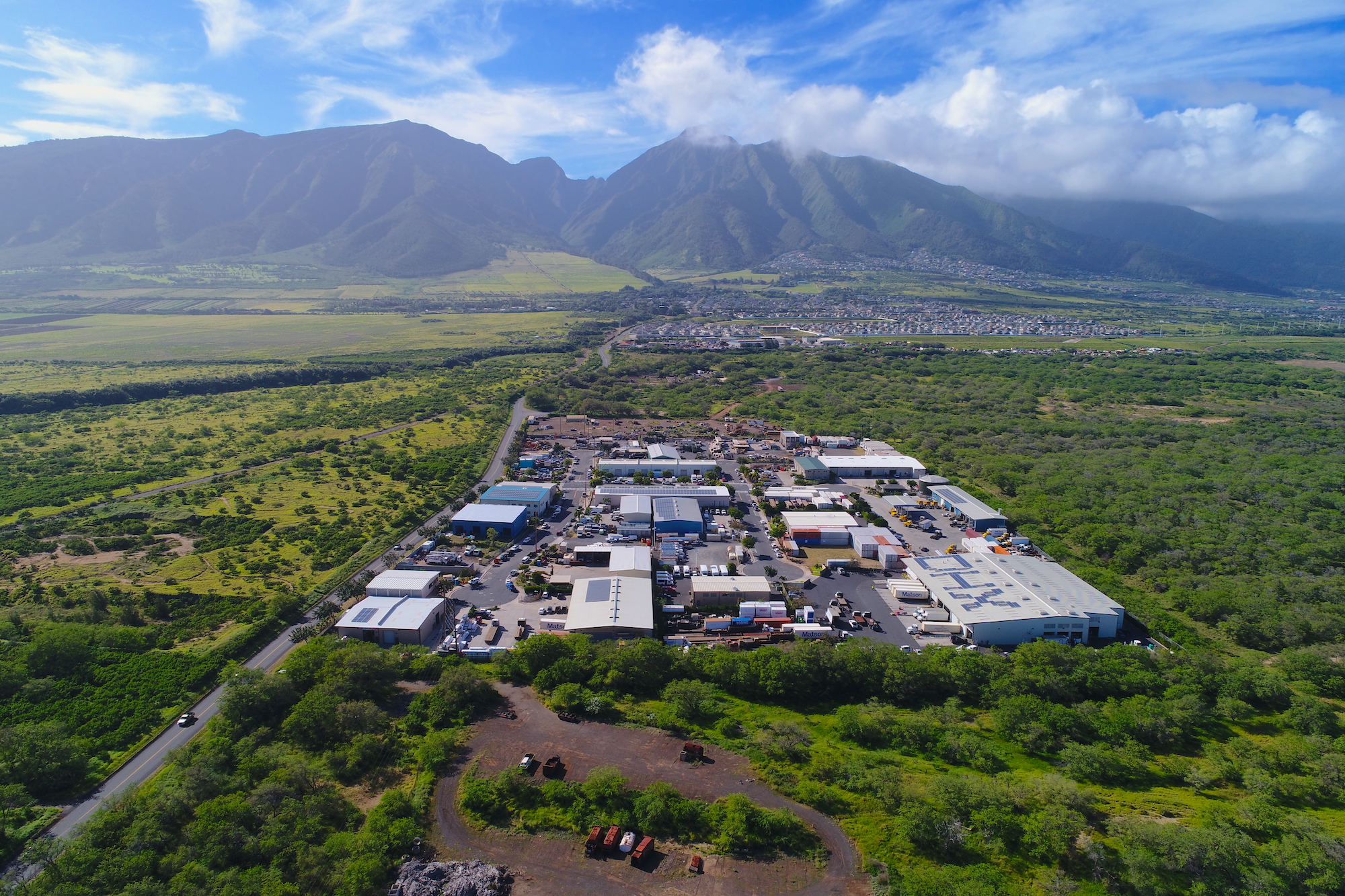
Drone based surveying
Cheaper than helicopter based aerial photography, drone based surveying can give you that bird’s eye view for a fraction of the cost. Commercial or residential lots, build progress, resource management …
-
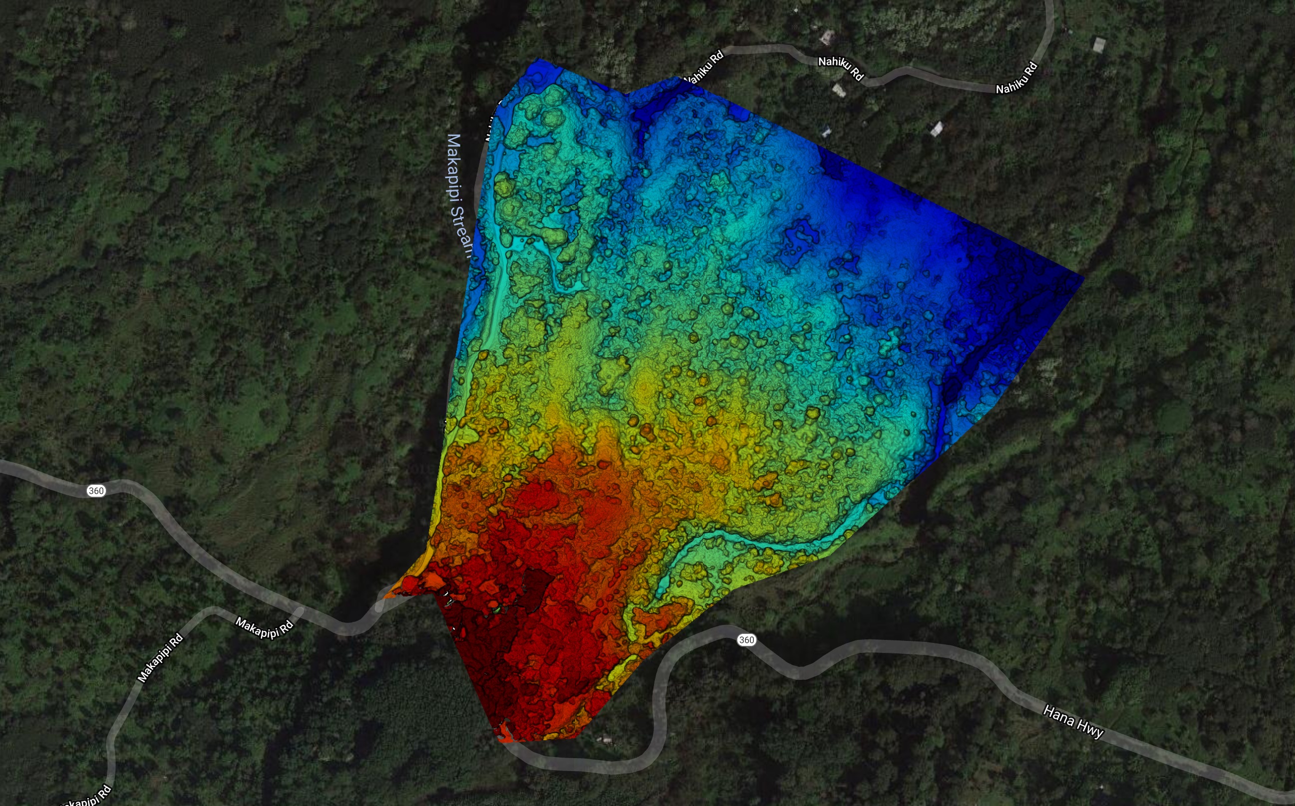
Elevation Survey
Drone surveying is a powerful tool for assessing undeveloped land, determining topography, examining plant health, and planning development.
-

Property surveys based on County GIS parcel boundary maps
We are now able to import government derived Property Boundary Maps directly into the drone software to create a survey parcel map with boundary lines GIS accurate within inches. Great …
-
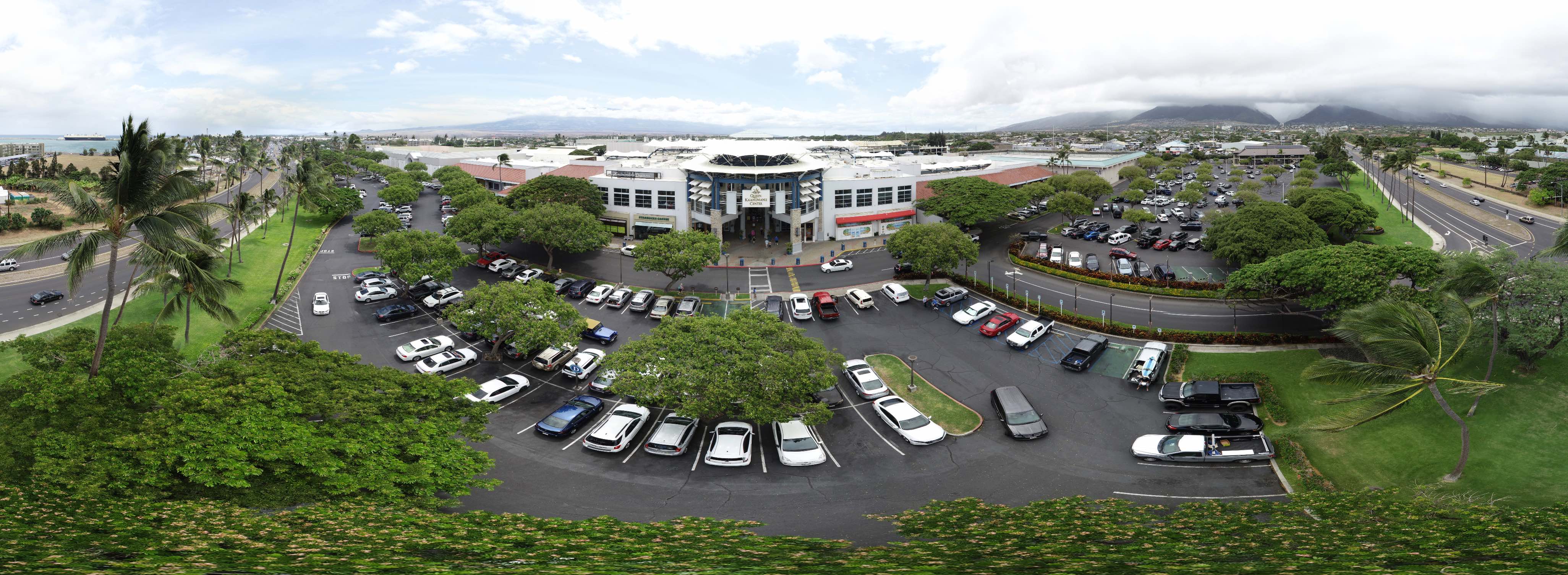
Queen Ka’ahumanu Center aerial photos and survey
This 47 acre property presented a significant challenge in that it was located half in and half out of an FAA Authorization Zone. In order to photograph and survey the …
Key Deliverables
Depending on your needs, the “stitched” data can be turned into several different products:
| Deliverable | What it is | Best Use Case |
| Orthomosaic Map | A massive, top-down 2D image made of hundreds of photos. | Site planning, land boundaries, and crop health. |
| 3D Point Cloud | A 3D model made of millions of individual data points. | Construction progress and BIM (Building Information Modeling). |
| Digital Elevation Model | A map showing the “ups and downs” of the terrain. | Flood risk assessment and drainage planning. |
| 360° Panorama | A “bubble” photo stitched from shots in all directions. | Real estate virtual tours and marketing. |